Education: Webinar Clips and Resources by Scientist/Educator
President
Earth and Space Research
Dr. Lagerloef completed a Ph.D. in Physical Oceanography at the University of Washington in 1984. In 1995, he co-founded Earth and Space Research, a non-profit scientific research institute in Seattle where he has developed several research projects devoted to studies of the upper ocean dynamics and climate variability using satellites.
In this clip, Dr. Gary Lagerloef discusses how scientists were able to use Aquarius data to observe major freshwater events in the Amazon River outflow and the Bay of Bengal.
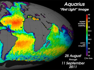
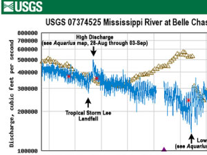
Dr. Gary Lagerloef uses data collected from NASA's Aquarius satellite to show ocean processes taking place in the Gulf of Mexico (September, 2011).
Dr. Gary Lagerloef explains how understanding ocean salinity can help us to better understand human-induced global climate change.
In this clip, Dr. Gary Lagerloef discusses how scientists were able to increase the accuracy of the Aquarius satellite through adequate sampling and broader spatial coverage.
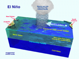
Using the El Niño event that occurs off the west coast of South America, Dr. Gary Lagerloef explains what natural salinity variability in the ocean looks like.
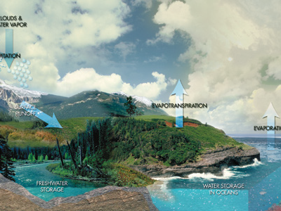
One way Aquarius data is being used is to better understand how the ocean and atmosphere interact: how they "couple" to create processes we experience on a daily basis like evaporation and precipitation.