Education: Obtaining, Evaluating, and Communicating Information
|
|
Aquarius Sees the Gulf of Mexico (00:02:48)
Dr. Gary Lagerloef uses data collected from NASA's Aquarius satellite to show ocean processes taking place in the Gulf of Mexico (September, 2011).
Comparing Ships to Satellites (00:04:33)
In this clip, Dr. Eric Lindstrom gives viewers a comparison between early seagoing vessels and earth-observing satellites.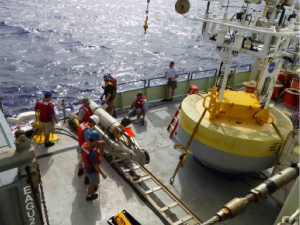
Constructing a Surface Mooring (00:07:18)
Dr. Tom Farrar dicusses how scientists design surface moorings to stay in one place in the middle of the ocean while simultaneously collecting data for up to one year at a time.
How are Humans Affecting Ocean Salinity? (00:07:00)
Dr. Gary Lagerloef explains how understanding ocean salinity can help us to better understand human-induced global climate change.
Introduction to the Argo Float Program (00:06:09)
Dr. Stephen Riser explains what an Argo float is and how it has increased scientists' knowledge of global ocean salinity since its implementation.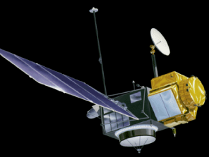
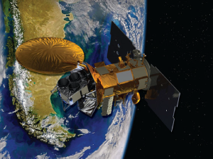
Ocean-Observing Satellites (00:07:37)
Ocean-observing satellites are able to measure a variety of properties including weather, salinity, temperature, and ocean color. Dr. Eric Lindstrom talks about the evolution of these satellites and how they have progressed to give us more detailed views of the worlds oceans from space.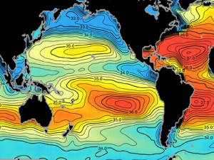
The Evolution of Open Ocean Exploration (00:03:14)
Dr. Eric Lindstrom talks about the connection between ocean-going vessels and ocean-observing satellites and how both are vital in learning more about how ocean circulation works and affects our planet.
What's Above a Mooring? (00:03:21)
Surface moorings collect continuous data from a single point in the ocean. Dr. Tom Farrar explains the types of instrumentation often found atop one of these moorings.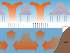
Why Care About Ocean Salinity? (00:04:37)
In this clip, Dr. Stephen Riser explains that ocean salinity is a way to better understand the global water cycle. Salinity plays a role in determining seawater density, which can determine where water travels throughout the oceans.