Education: Satellite and In-Water Instruments as Complementary Tools
Satellites are being used by scientists to study large-scale processes in the ocean and are very effective at collecting a large amount of data in a relatively short time. But to validate this information, scientists need another collection method: this is where in-water instrumentation comes in. Using these tools conjointly, scientists are able to produce more accurate data sets.
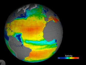
Sea surface salinity research has come a long way, initially being measured from ships and more recently with autonomous floats such as wave gliders and Argo. Beginning in the mid 1970s, satellites were launched into space to measure various oceanographic processes.
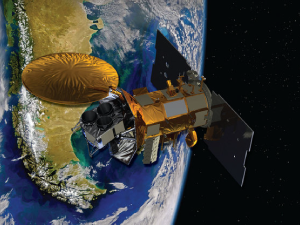
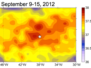
Dr. Gary Lagerloef uses data collected from NASA's Aquarius satellite to show ocean processes taking place in the Gulf of Mexico (September, 2011).
In this clip, Dr. Eric Lindstrom gives viewers a comparison between early seagoing vessels and earth-observing satellites.
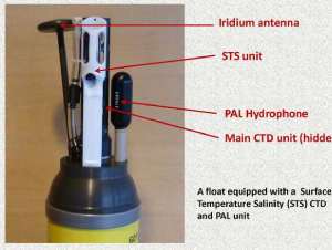
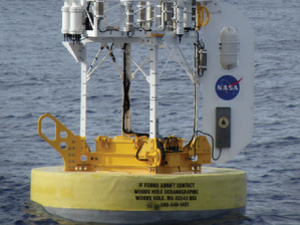
In order to better compare Aquarius satellite data (measuring global ocean salinity) to autonomous float data, the scientists involved with the Argo program engineered an "Advanced Argo Float".
Dr. Tom Farrar explains what scientists mean when they talk about ocean salinity and defines the associated values.
Dr. Fred Bingham talks how using both satellites and in-situ equipment is creating a more accurate picture of processes occurring in the salty Atlantic.
Collecting data has many challenges, whether it is in the ocean, or the vast and hostile environment of space. Dr. Eric Lindstrom addresses some of the challenges of collecting good data in difficult conditions.