Education: JPL Salinity Workshop
This workshop focused on pairing educators with NASA scientists to explore the concepts and data from the Aquarius mission. A subset of experienced "master teachers" worked directly with the scientists to become content experts who could guide and facilitate other teachers in finding resources to fit into their own classroom needs.
This experience provided the resources to help understand, explain and teach:
- How the processes of the water cycle relate to the oceans
- How ocean salinity affects ocean circulation
- How changes in the ocean's circulation can produce large changes in climate
- How new technology can enhance the gathering and manipulation of oceanic data
JPL Salinity Workshop: Water Cycle, Circulation and Climate
November 9-10, 2012NASA/Jet Propulsion Laboratory, Pasadena, CA
Participating Scientists

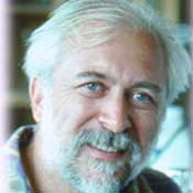
Dr. Chao received his Ph.D. from Princeton University (Atmospheric and Oceanic Science Program, NOAA Geophysical Fluid Dynamics Laboratory). His research interests include satellite oceanography with a particular focus on coastal oceans; ocean modeling, data assimilation and forecasting; interdisciplinary science of coupling ocean circulation with ecosystem and air-sea interactions; and climate variability and change.

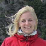
Michelle Gierach
NASA/Jet Propulsion Laboratory
Concept Map: How Does Salinity Drive Ocean Circulation?
Dr. Gierach received her Ph.D. in Marine Science from the University of South Carolina. Her research interests include application of satellite observations, in-situ data, and model simulations to study biophysical interactions, ecosystem dynamics, air-sea interactions, ocean dynamics, atmospheric processes, and the oceans relation to climate variability.

Josh Willis
NASA/Jet Propulsion Laboratory
Concept Map: What Are the Connections Between Climate and Heat Stored in the Ocean and Atmosphere?
Dr. Willis received his Ph.D. in Oceanography from Scripps Institution of Oceanography, University of California, San Diego, La Jolla, California. His research interests include estimating ocean warming and sea level rise on regional to global scales; the role of the ocean in the Earth's climate system under global climate change; understanding large scale changes in the ocean and its circulation on interannual to decadal time scales; and development of analysis techniques for global oceanographic data sets.

Zhijin (Gene) Li
NASA/Jet Propulsion Laboratory
Concept Map 1: What Are Models and How do they Work?
Concept Map 2: How is Ocean Modeling Used in the SPURS Expedition?
Dr. Li, a research technologist at JPL, studies conceptual development and mathematical formulation of atmospheric and oceanic data assimilation algorithms; implementation of advanced data assimilation algorithms for real-time forecasting systems; parallel computing of atmospheric and oceanic modeling and adjoint systems; development and application of adjoint models associated with sophisticated atmospheric and oceanic models and their physics; and predictability.

Dr. Capone received his Ph.D. in Oceanography from the Rosenstiel School of Marine and Atmospheric Sciences of the University of Miami (Fl). His research interests include learning about bacteria's ability to promote the absorption of greenhouse gas; the importance of nitrogen fixation in the biogeochemistry of the oceans and the major groups of organisms involved in this process; experimental manipulation of nutrient dynamics in coral reefs systems; the examination of South Pole snows for active populations of bacteria; and analyses of microbial processes in mangrove ecosystems.
Guest Speakers
NASA scientists Jorge Vázquez and Vardis Tsontos facilitated a session during the workshop on how to access salinity data
online using the PO.DAAC system. Walking through the PO.DAAC website, Jorge and Vardis
demonstrated how to access Aquarius data and previewed data products that educators could use in their classrooms.
Jorge Vázquez
NASA/Jet Propulsion Laboratory

Vardis Tsontos
NASA/Jet Propulsion Laboratory