Gallery
Annual Mean Surface Salinity Data
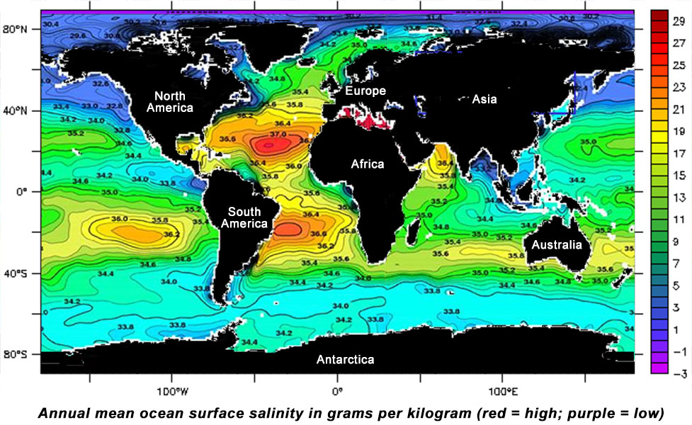
[14-Apr-11] Interpolated annual mean ocean surface salinity data based on historical measurements by ships and buoys. Reds indicate high salinity values (37 Practical Salinty Units, PSS, or higher) and dark blues indicate areas of low salinity (33 PSS or lower). PSS is roughly equivalent to parts per thousand.Image shows the Passive-Active L- and S-band (PALS) sensor in the C-130 aircraft that was used during flights over Monterey Bay (California) in 2000 and 2003. These experiments were conducted over a range of longitudes (37 to 37.4 degrees) and salinity (31 to 35 on the Practical Salinity Scale, PSS, roughly equivalent to parts per thousand). Credit: World Ocean Atlas.View: Click on the image to enlarge. Click on the Escape key or anywhere outside the shadowbox to close.
Download: To download a copy, right click on the image and select Save Image As (on a Mac keyboard, click the touchpad while holding down the Control key). To download the highest resolution in our database, first click on the image to enlarge and then save that version.