Education: Developing and Using Models
|
|
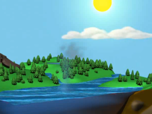
A New View on the Water Cycle (00:05:17)
Dr. Raymond Schmitt discusses the role that heat plays in warming the ocean and fueling the water cycle, making the case for a more globalized view of the water cycle.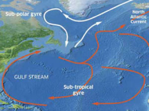
Earth's Rotation Influences Ocean Currents (00:07:31)
In this clip, Julius Busecke discusses how the interactions between atmospheric circulation and the rotation of the earth interact to produce large scale gyres in the North Atlantic Ocean.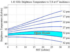
Mesoscale Eddies: The Weather of the Ocean (00:05:26)
In this clip, Ph.D student Julius Busecke explains that through his research, he is trying to determine how freshwater is carried throughout the ocean and how mesoscale eddies in the ocean are affecting properties like ocean salinity.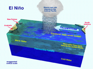
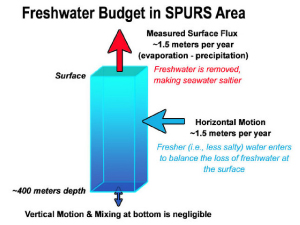
Natural Variability In Ocean Salinity (00:02:53)
Using the El Niño event that occurs off the west coast of South America, Dr. Gary Lagerloef explains what natural salinity variability in the ocean looks like.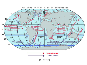
The Aquarius Satellite and SPURS (00:02:50)
Dr. Fred Bingham talks how using both satellites and in-situ equipment is creating a more accurate picture of processes occurring in the salty Atlantic.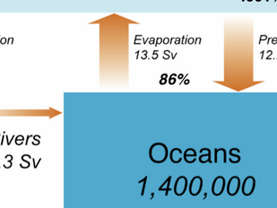
Why Worry About the Ocean? (00:01:05)
In this clip, Ph.D student Julius Busecke walks us through why we should be concerned about the ocean, due, in part, to evaporation and precipitation. Although we think of these processes as largely land-based phenomena, they actually take place on a much larger scale over the ocean.